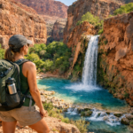
Danger has always been part of hiking’s appeal. Not because hikers actively seek harm, but because stepping into wild landscapes carries an element of uncertainty that cannot be replicated in everyday life. High cliffs, unpredictable weather, steep terrain, and remote wilderness all demand respect. The trails that gain reputations as America’s most dangerous are rarely dangerous because they are poorly designed. They become dangerous because nature has a way of exposing mistakes quickly and without mercy.
Over the years, I have hiked routes that tested my endurance, judgment, and ability to stay calm under pressure. Some featured knife-edge ridges with thousand-foot drop-offs. Others crossed deserts where dehydration posed a greater threat than any cliff. The common thread among all of them was simple: preparation mattered more than courage. America’s most dangerous hiking trails can provide unforgettable adventures, but only for hikers who understand the risks and know how to manage them.
- Angels Landing, Zion National Park
- Half Dome, Yosemite National Park
- Kalalau Trail, Hawaii
- Bright Angel Trail, Grand Canyon National Park
- Presidential Traverse, White Mountains
- Knife Edge Trail, Mount Katahdin
- The Maze, Canyonlands National Park
- Aonach Eagach Style Exposure on Capitol Peak
- The Barr Trail, Pikes Peak
- The Subway Route, Zion National Park
- Common Mistakes That Turn Difficult Trails Into Dangerous Ones
- Survival Principles That Apply Everywhere
- Final Thoughts
Angels Landing, Zion National Park
Few trails in the United States generate as much discussion as Angels Landing. Located in Zion National Park, this iconic route climbs steeply through switchbacks before reaching a narrow ridge lined with chains. The final section features sheer drop-offs on both sides, creating an experience that many hikers describe as exhilarating and terrifying at the same time.
The physical difficulty is only part of the challenge. Exposure is what makes Angels Landing notorious. Strong winds, crowded conditions, and nervous hikers can create dangerous situations if people lose focus. Even experienced hikers often feel their pulse quicken while navigating the final ridge.
Survival on Angels Landing begins with patience. I avoid the trail during storms, high winds, or periods of extreme crowding. Moving deliberately, maintaining three points of contact when using chains, and resisting the urge to rush dramatically reduce the risk. Confidence helps, but caution matters far more.
Half Dome, Yosemite National Park
Half Dome stands among the most recognizable landmarks in America. The massive granite summit towers above Yosemite Valley and attracts hikers from around the world. Reaching the top requires a strenuous climb and a final ascent using steel cables attached directly to the rock face.
The greatest danger often comes from weather. Granite becomes extremely slippery when wet, turning the cable section into a hazardous obstacle. Lightning poses another serious threat because hikers are exposed on the upper portions of the route with little shelter available.
I have always considered weather forecasting the most important survival tool for Half Dome. Starting early allows plenty of time to descend before afternoon storms develop. Carrying extra water, monitoring energy levels, and turning around if conditions deteriorate are decisions that can prevent a memorable adventure from becoming a rescue operation.
Kalalau Trail, Hawaii
The Kalalau Trail along Kauai’s Na Pali Coast combines extraordinary beauty with genuine danger. The route traverses steep cliffs overlooking the Pacific Ocean while crossing streams that can become treacherous after heavy rain. Dense vegetation and rugged terrain add additional challenges throughout the journey.
One section known as Crawler’s Ledge receives particular attention. The narrow path hugs a cliff face where a misstep could have severe consequences. Although the trail is passable under normal conditions, changing weather can dramatically increase the level of risk.
Surviving Kalalau requires respect for Hawaii’s rapidly changing environment. I never underestimate stream crossings because flash floods can occur unexpectedly. Monitoring weather forecasts, carrying emergency supplies, and avoiding risky decisions simply to maintain a schedule can make all the difference.
Bright Angel Trail, Grand Canyon National Park
Many hikers are surprised to see Bright Angel Trail included among dangerous routes. The path itself is well maintained and heavily traveled. The danger comes from the canyon’s unique environment rather than technical obstacles.
Descending feels deceptively easy. The problem begins when hikers realize that everything they walked down must eventually be climbed back up. Extreme heat, dehydration, and exhaustion contribute to numerous rescues every year. Temperatures at the canyon floor can exceed what many visitors have ever experienced.
The smartest strategy is pacing. I constantly monitor water consumption and avoid pushing beyond my fitness level. Turning around earlier than planned is far wiser than discovering halfway up the canyon that energy reserves have disappeared.
Presidential Traverse, White Mountains
New Hampshire’s Presidential Traverse offers some of the most challenging hiking conditions in the eastern United States. The route crosses multiple peaks while exposing hikers to weather conditions often compared to those found in alpine environments much farther north.
Wind speeds can become extreme. Dense fog may reduce visibility to only a few feet. Temperatures can change dramatically within a short period of time, even during summer. The combination creates a setting where navigation errors and poor preparation can quickly become serious problems.
My survival strategy begins with flexibility. Summit goals mean little compared to safety. Carrying layers, checking forecasts repeatedly, and accepting that plans may need to change are critical habits on this route.
Knife Edge Trail, Mount Katahdin
Mount Katahdin marks the northern terminus of the Appalachian Trail and contains one of the most intimidating ridge walks in America. The Knife Edge Trail follows a narrow ridgeline featuring steep drop-offs and exposed scrambling.
Unlike some dangerous trails that rely primarily on psychological exposure, the Knife Edge demands physical movement across challenging terrain. Strong winds can increase the difficulty substantially, particularly when hikers are crossing narrow sections of the ridge.
The best way to survive the Knife Edge is to avoid forcing the issue. If weather conditions become unfavorable, turning back remains the safest option. I have learned that mountains will always be there another day, while stubborn decisions can have lasting consequences.
The Maze, Canyonlands National Park
The Maze district of Canyonlands National Park presents a different type of danger. Rather than steep cliffs or exposed ridges, the primary threat comes from isolation. This region is one of the most remote locations in the American national park system.
Navigation can become difficult even for experienced hikers. Cell service is virtually nonexistent, water sources are scarce, and help may be hours or days away. Small mistakes can quickly escalate into major problems because assistance is not readily available.
Preparation becomes the defining factor here. I carry detailed maps, navigation tools, and extra supplies whenever traveling in remote desert environments. Self-reliance is not optional in places where rescue operations are complicated and time-consuming.
Aonach Eagach Style Exposure on Capitol Peak
Capitol Peak in Colorado has earned a reputation as one of the most dangerous fourteeners in the state. The infamous Knife Edge section requires hikers to cross a narrow ridge with significant exposure on both sides.
The technical difficulty exceeds what many casual hikers expect. Confidence, balance, and route-finding skills all play important roles. Weather can further increase the challenge, particularly when storms develop during the ascent.
I have found that honest self-assessment is essential before attempting routes like Capitol Peak. Ambition should never replace experience. Hikers who gradually build skills on easier peaks often make safer decisions than those attempting difficult objectives prematurely.
The Barr Trail, Pikes Peak
Barr Trail may not feature terrifying drop-offs, but its length and elevation gain create significant challenges. The route climbs more than 7,000 feet to the summit of Pikes Peak, exposing hikers to altitude-related issues and rapidly changing weather.
Altitude sickness can affect individuals regardless of fitness level. Symptoms such as headaches, nausea, and dizziness may appear unexpectedly. Combined with physical fatigue, these factors can create dangerous situations for unprepared hikers.
Gradual acclimatization provides one of the best defenses. I pay close attention to how my body responds at higher elevations and remain willing to adjust plans if symptoms appear. Reaching a summit is never worth compromising health.
The Subway Route, Zion National Park
The Subway has become one of Zion’s most sought-after adventures. Unlike traditional trails, much of the route involves navigating through a canyon environment featuring water crossings, slippery surfaces, and complex terrain.
Flash floods represent the greatest threat. Conditions can change rapidly, and water levels may rise with little warning. The canyon’s narrow walls can limit escape options once a flood develops.
Checking forecasts is mandatory rather than optional. I also carry appropriate gear for wet conditions and maintain awareness of changing weather patterns throughout the day. Preparation transforms the experience from risky to manageable.
Common Mistakes That Turn Difficult Trails Into Dangerous Ones
Many accidents occur because hikers underestimate conditions rather than because trails are inherently deadly. Overconfidence often proves more dangerous than a lack of experience. People frequently ignore weather warnings, carry insufficient water, or continue despite obvious signs of fatigue.
Poor navigation remains another common problem. A wrong turn on a popular trail may create a minor inconvenience, but in remote environments it can become a serious emergency. Technology helps, yet batteries fail and signals disappear. Traditional navigation skills still matter.
Group dynamics can also contribute to bad decisions. Hikers sometimes continue beyond their comfort level because they do not want to slow others down. I have learned that speaking up about concerns early is far easier than dealing with problems later.
Survival Principles That Apply Everywhere
The most valuable survival skill is decision-making. Expensive gear and advanced fitness mean little if judgment disappears under pressure. Knowing when to continue, when to wait, and when to turn around often determines the outcome of a hike.
Weather awareness consistently ranks among the most important factors. Mountains create their own conditions, and forecasts can change quickly. Checking weather reports before departure and monitoring the sky throughout the day provide critical information.
Carrying essential gear is equally important. Water, food, navigation tools, emergency layers, and first-aid supplies should accompany hikers even on routes that seem straightforward. Emergencies rarely announce themselves in advance.
Final Thoughts
Wild places demand respect, and the trails featured here have earned their reputations through a combination of exposure, weather, remoteness, and physical challenges. America’s most dangerous hiking trails attract adventurers because they offer extraordinary experiences, but they also punish carelessness more quickly than ordinary routes.
The key to surviving these trails is not fear. It is preparation, humility, and good judgment. The hikers who return safely from difficult adventures are rarely the strongest or fastest. More often, they are the ones who recognize risks early, adapt to changing conditions, and remember that reaching home safely is always the most important goal.